Questions? Call 1-844-905-1001
Lac Seul
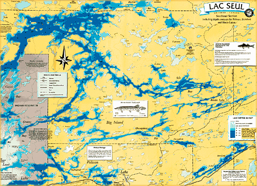
Lac Seul is a large, crescent shaped reservoir in Kenora District, northwestern Ontario, Canada. It is approximately 241 km (150 mi) long. It has a maximum (regulated) depth of 47.2 m (155 feet), with a surface elevation of 357 m (1,171 feet) above sea level. Lac Seul is huge with over 3,000 miles of shoreline and covers 358,400 acres (560 square miles) and a surface area of 1,657km2 (640 sq. mi). Lac Seul holds seventh place of the top 10 lakes in Ontario next to Lake Superior, Lake Huron, Lake Erie, Lake Ontario, Lake Nipigon, Lake of the Woods, Lake St. Clair, Rainy Lake and Lake Abitibi. And is the second largest body of water entirely within the province of Ontario, next to Lake Nipigon being first. Lac Seul is located on the former lake bed of Glacial Lake Agassiz. Owing to this previous lake, much of the bottom of Lac Seul is covered with thick deposits of lacustrine silts and varved clay of varying thickness. Lac Seul is a lake that is not a dish pan bottom, it is a flooded timber area of valleys and hills along with the rocky Canadian Shield covered in water. What were at one time creeks are now rapids or deep troughs and the flat areas are now bays with stumps still sticking up out of the water. The flooding of Lac Seul was a result of the construction of the dam at Ear Falls in 1929 which had a devastating effect of the Lac Seul First Nation (as known as Obishikokaang) communities of Kejick Bay, White Fish Bay and Frenchman’s Head. The community of Kejick Bay became an island, separated from the mainland. Today Lac Seul First Nation (Obishikokaang) plays a leading role in the management of all natural resources within their traditional territories.
Its level is raised in the summer and then drawn down in the winter months to reach points of as low as 16 feet below the maximum level. The lake consists of open water bays, narrow channels, and islands. It is a relatively shallow lake with many rock shoals. This provides a good habitat for Walleye aka Yellow Pickerel and Northern Pike as well as Yellow Perch. During the Lac Seul project of 1968-1972 no Muskellunge aka Masquinonge were noted in the catches of research nets set over those years. Significant numbers of Whitefish, Tullibee, Burbot and Cisco were noted as well although they infrequently were noted in the sport fishery. Lac Seul is noted for offering some of the best fishing in Ontario.
The water of Lac Seul is tea colored. In clear water Walleye only feed at dusk and dawn because of their light-sensitive eyes, but because of the tea color of Lac Seul, it provides excellent Walleye and Northern Pike angling opportunities throughout the day.
Lac Seul provides some of the finest trophy Northern Pike and Walleye and also provides access to the vast, practically untouched wilderness surrounding it.
The numerous islands on Lac Seul are considered regionally significant calving habitat for the rare boreal woodland caribou. The boreal woodland caribou population (forest-dwelling), estimated at approximately 3,000, make up approximately one-quarter of Ontario's woodland caribou, was designated as threatened in 2000 and likely to become endangered if limiting factors are not reversed.
The natural capacity of Lac Seul is augmented by the diversion of water from the Albany River drainage basin at Lake St. Joseph, allowing hydroelectric stations at Ear Falls where the English River leaves the lake, and Manitou Falls, 30 km downstream, to generate 90600 kW of electricity.
In fur trade days it was part of a canoe route west from James Bay: James Bay, Albany River, Lake St. Joseph, portage, Lac Seul, English River (Ontario), Winnipeg River, Lake Winnipeg.
Vermilion River (Lac Seul) is a tributary of Lac Seul on the English River. The Vermilion River is a river in the Hudson Bay drainage basin in Kenora District in Northwestern Ontario, Canada. The river begins at Highstone Lake and reaches its mouth at Brechin Bay on Lac Seul, about 35 kilometres (22 mi) north of the town of Sioux Lookout, which flows via the English River, Winnipeg River and Nelson River to Hudson Bay. Other tributaries that feed into Vermilion River are Tully Creek, Bump Creek, Sigurd Creek and Per Creek. GPS Coordinates for the mouth of Vermilion River at Lac Seul is 50°25′05″N 91°50′11″W
Lac Seul is surrounded by the nearby communities of: Ear Falls, Goldpines, Lac Seul First Nation - Lac Seul 28 Indian Reserve, Lac Seul Post, Sioux Lookout, Wabauskang First Nation - Wabauskang 21 Indian Reserve and Hudson.
Lac Seul is by far the largest fresh water fishery in the area with more than 100 miles in length. Good navigation skills and a good map with a good sense go hand in hand on this big lake. The locals say that you can fish Lac Seul for a lifetime and still not able to discover the entire lake. Lac Seul is the second largest inland fishery in all of Ontario. It has its own fishing regulations in order to ensure the fishery remains healthy for generations to come. When fishing Lac Seul you have the opportunity to fish four different species on any given day. Lac Seul is famous for its yields of Walleye as the most popular species, and then of course there is Northern Pike, Muskie and Smallmouth Bass. Lac Seul offers something for everyone, no matter what your preference is. Lac Seul is accessed by several launches located throughout the area.
The closest launch that Nutt’s Country Cabins’ guests use is located just two miles from camp called Lost Bay Launch. If assistance is required in respect to trailering your rental boat we are more than happy to include this service. The next most popular access is located just 20 miles north of town called Deception Landing. Both launch areas are maintained by the town of Sioux Lookout who pride themselves in providing our visitors with facilities that are kept in top notch condition at all times. You could also travel by boat from Big Vermilion Lake, through Pelican Lake to reach Lac Seul by boat as well. There is a public boat launch right next door to the camp into Big Vermilion Lake and less than a 3 min boat ride to Pelican Lake from this boat launch.
As mentioned Lac Seul is the second largest body of water located entirely within Ontario, Canada and because this lake is shallower compared to some of the other lakes in Canada, many anglers find it easier to find some of the hot spots that hold Walleye, Northern Pike, Smallmouth Bass, Muskie and Perch. It is one of the premier drive-in lakes in Canada for catching Walleye and Northern Pike.
Northern Pike in the 6 to 10 pound range are very common with many fish available in the 15 to 20 pound range. You should be able to catch Walleye in the 2 to 4 pound range all day with many bigger fish being common. You will find many bays, islands and narrow channels where you can target Smallmouth Bass. Many anglers also prefer fishing for Lake Trout and Whitefish. There are plenty of options for anglers on Lac Seul.
Would you like more info? Please call us toll free at 1-844-905-1001 or email us at info@nuttscountrycabins.com for more information and to plan your trip with Nutt’s Country Cabins on beautiful Lac Seul. You will be happy you made the call.
Wind: 8mph SW
Humidity: 76%
Pressure: 29.76"Hg
UV index: 3
81°F / 61°F
72°F / 52°F
Nutt's Country Cabins, 2076 Highway 664, Sioux Lookout, ON P8T 0A7
Copyright © 2019 NuttsCountryCabins.com | Privacy Policy | Website design by: Little Dragon Media